1 this was published in 2020 and new data will be added
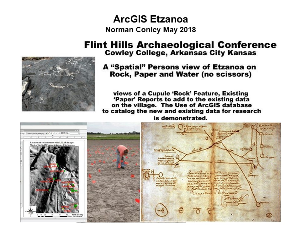
This is about the building of a data base of the Etzanoa community. Starting with the information we now have and adding analysis of remote sensing and new research.
2 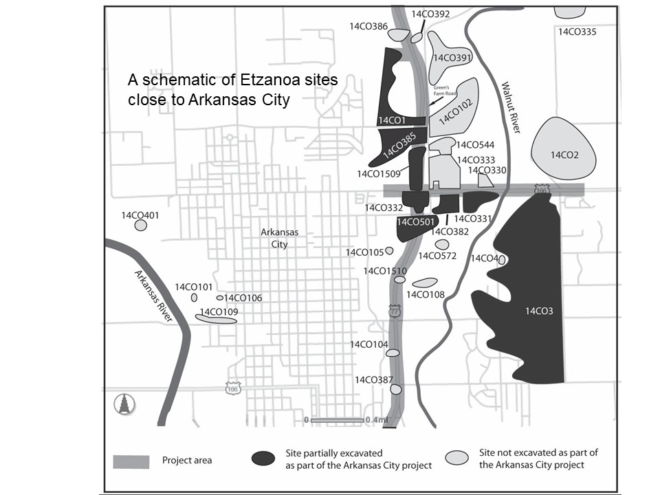
With a few exceptions Etzanoa today is private property so we depend on remote sensing to target rich potential sites to study in detail. We began in the Arkansas City area and need to extend this analysis up the Walnut River toward Augusta. We hear from the video you will see tonight that Onate was the first recorded European in the area (1601) and that did not go well. The next report comes from a Captain James Bell in 1820 who gives a picture of the area when the Osage used it based on his description. He crossed the stinking fork (Walnut) maybe a mile from its mouth in the Arkansas. He does not report on any large willages or mounds but this was 200 years later.
3 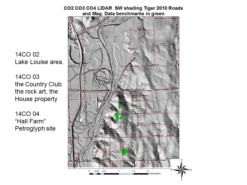
4 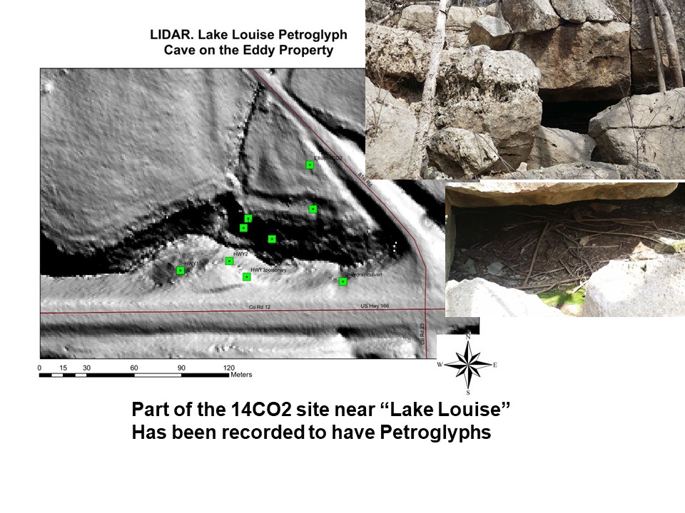
5 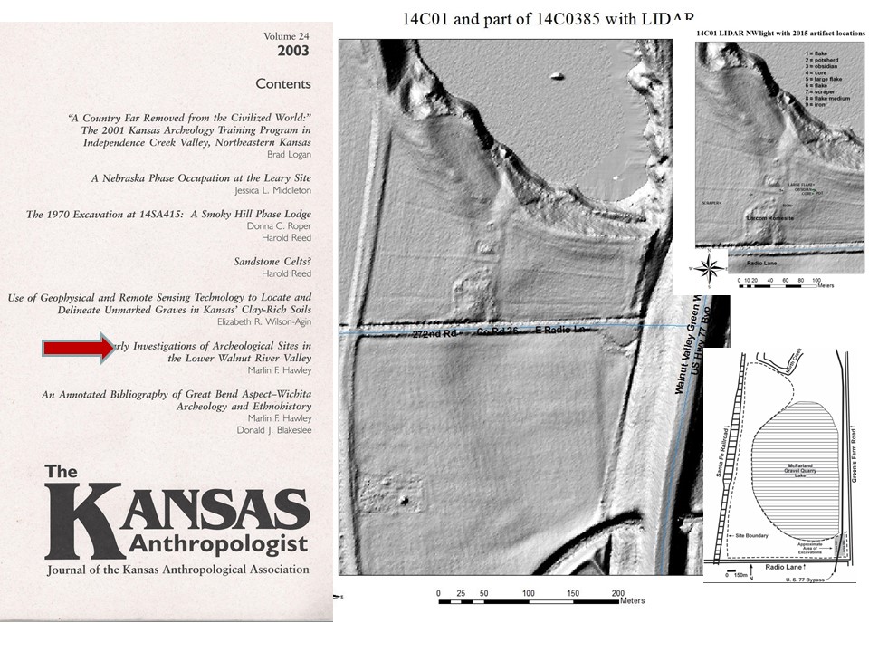
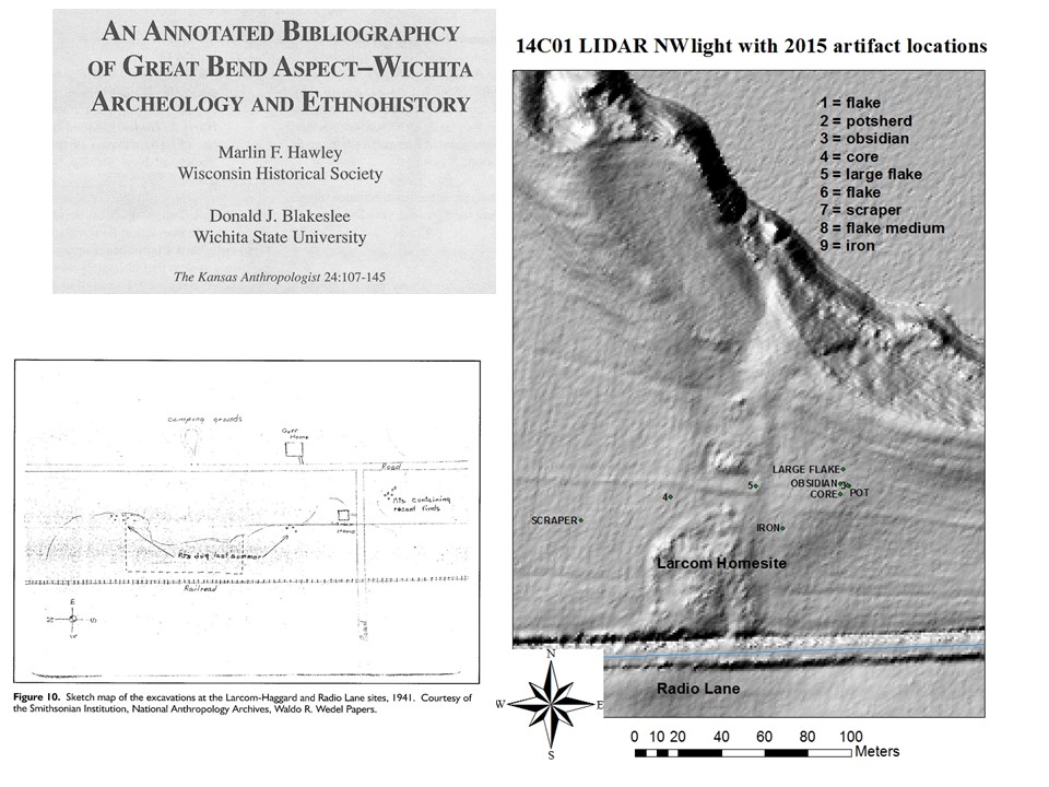
Early investigations of the 14 CO 01 Larcom – Haggard site have been documented. The mapping leaves a lot to be desired from 1941. The Wedel report does describe a small circular basin 14 inches deep by 28 inches in diameter that was packed full of thousands of flint chips…two knives, a scraper and a few bones. Well in 2015 we flagged that material or another basin that had been spread in the same area by the plow. These flags also appear in the video.
6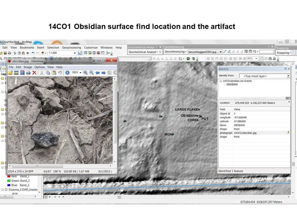
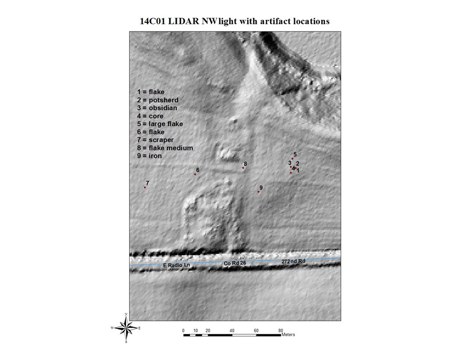
In the general area of the chip scatter we found large flake, core, pot sherd and a piece of obsidian shown here. The data base then shows the details of the likely Valle Grande spall from NW New Mexico.
7 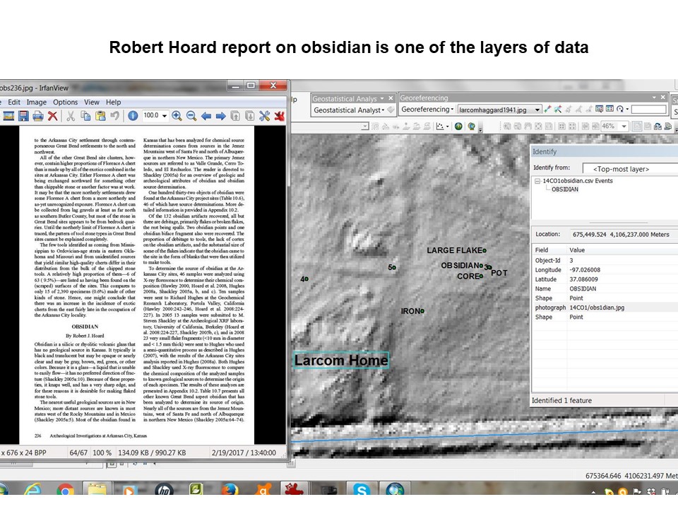
8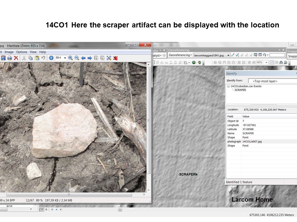
Here is a scraper that will be joined by a metric picture of the artifact and more descriptive information on the scrapers found to date and now for a public service announcement
9 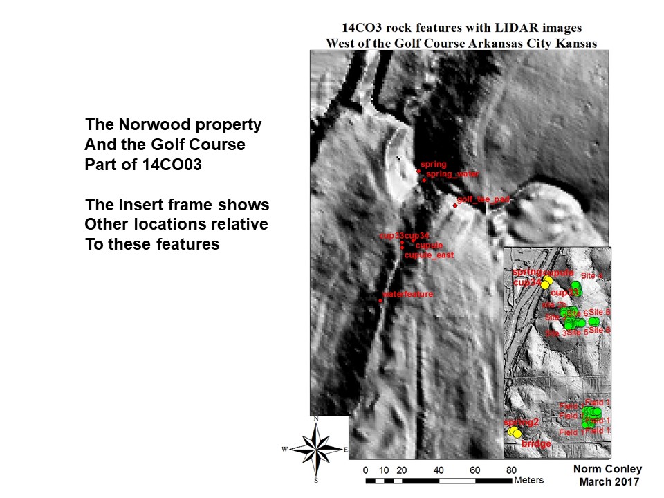
The largest site is the Country club 14CO 03 site. We have added more features to the data base since 2015. Here we see the Norwood Property and the escarpment formed by the juncture of the Flint hill limestone with the Arkansas River basin. The first feature is one of two large springs described by Wedel in his report shown here with a metric north pointing stick and the UTM coordinates for the picture.
10 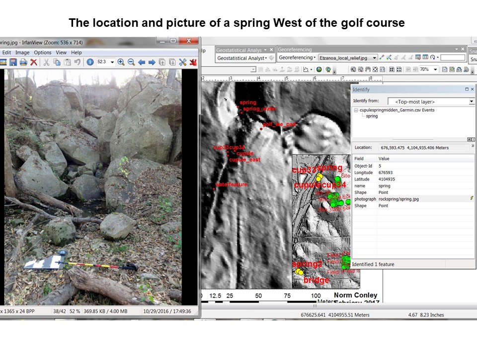
11 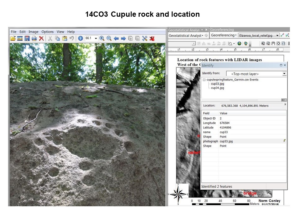
Cupules are the most common and the oldest rock art. 1 ½ to 10 cm in diameter Cupules are artefacts of practice and reflect the actions, representation, and negotiations of people who were pounding on boulders and bedrock. …. who historically pounded cupules on landscape features to communicate with the spiritual world through prayers and offerings. … This suggests that long-lived practices of prayer (creating cupules) ….were reinterpreted in the crucible of dramatic social and residential transformation.
12 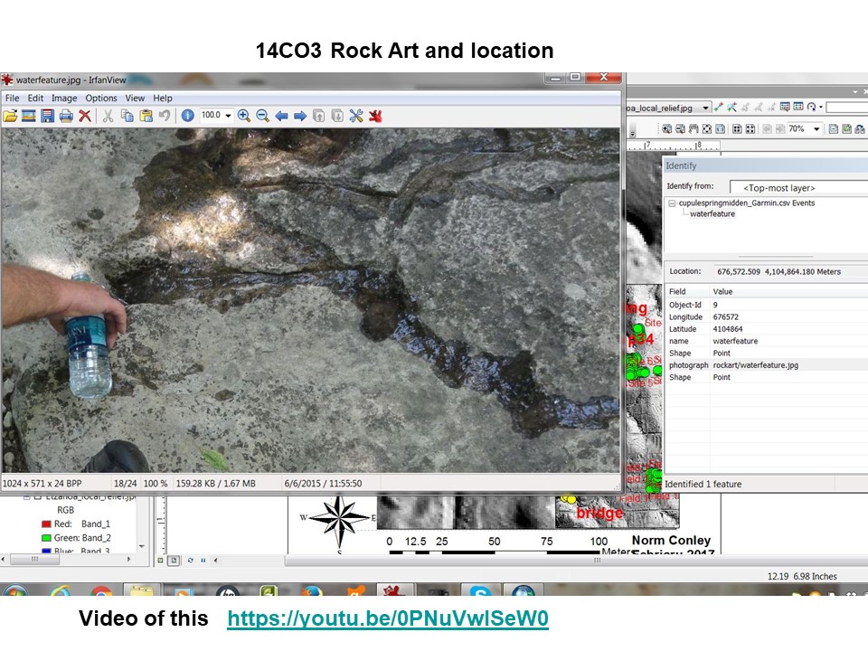
The rock art on 14CO3 Norwood property is very entertaining. As it is an anomaly in design and the square edges of the work suggest it is post contact and that metal tools have been used to chip the water falls in the stone. The connection with the pre historic is the ‘cave’ indentations at the source of the water paths. If this is prehistoric it is enigmatic in its meaning beyond a suggestion in the video.
13 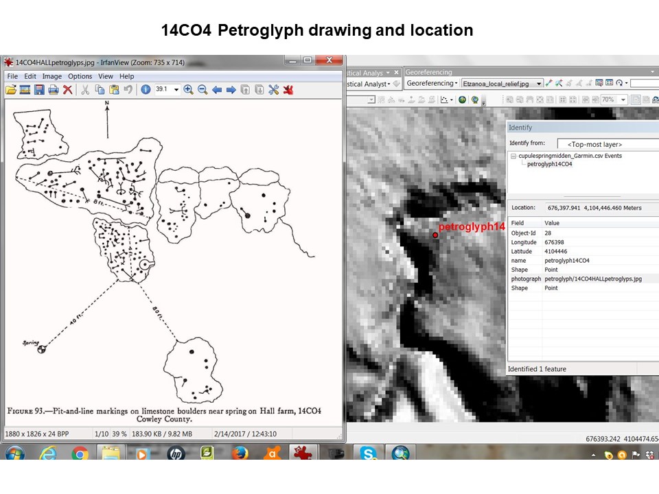
Nicely rendered by a local the 14CO4 Petroglyphs are more cupule pecking with linear lines appearing to be anthropomorphic in nature. Compared to the Norwood Cupule rocks. Melanie Naden rocks are described in Wedels report Bureau of American Ethnology. There is also a photograph of the site in the database.
14 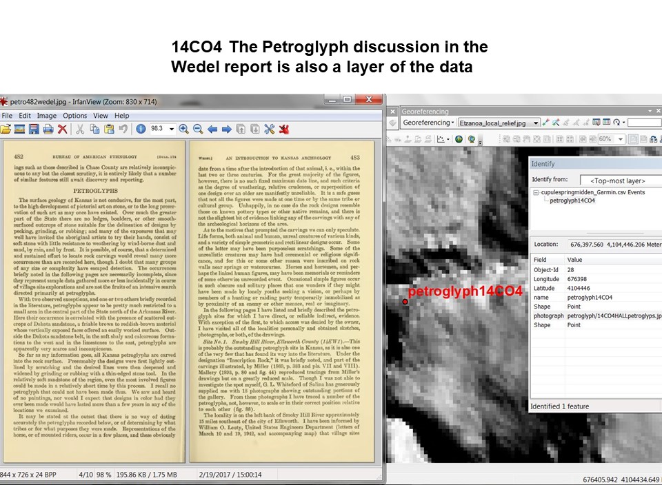
15 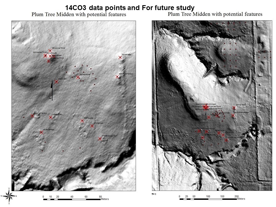
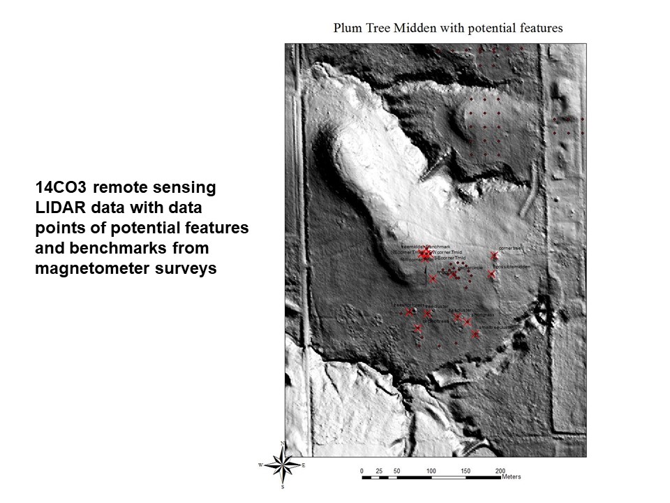
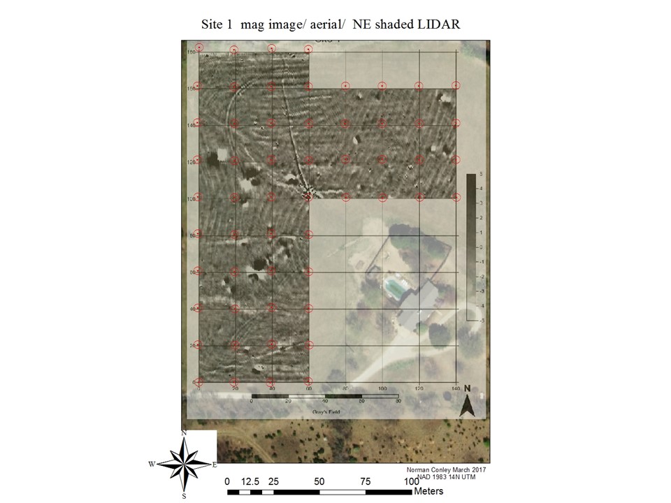
Mrs. Carol House property was worked this summer and continues through the 2021 seasonand specifically the plum tree midden. Here we see other potential features on the LIDAR image. Walking the field to see if some looked promising at ground level proved that ‘cheat grass’ is a diagnostic , tree clusters maybe diagnostic. The House property includes magnetic imaging done in 2015 as well as a perfect location to run a viewshed to see what can be seen to the north of her house on a ‘promontory’ understanding that today trees may be in the way of what the ancient view was.
16 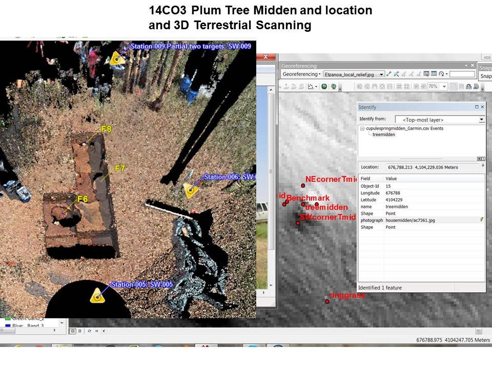
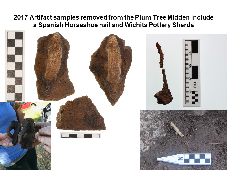
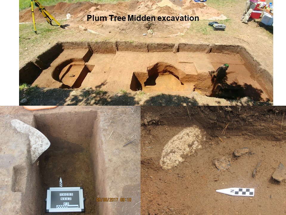
Here is the plum tree midden that produced trash artifacts during the week or so excavation. The dip in the center and a patch removed to the south are evidence of mining for treasure/ artifacts. A comment at this point is that the current and reported evidence points to these being trash heaps covered by dirt to keep the sherds from cutting feet. The evidence also points to there being storage pits used for trash below these mounds. All cultural evidence points to the house floors as being clean to avoid damage to the people living inside.
17 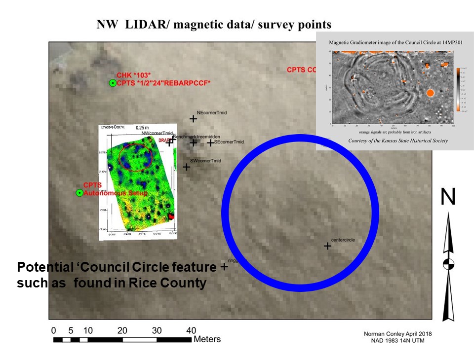
Concentric Feature from LIDAR suggests a council circle common to the Wichita and seen above in Rice County
18 
Here I conclude the House site with a geo referenced magnetic image over the aerial view. The data include a LIDAR LAYER that in concert with one another point to an occupation location and likely trash pits.
19 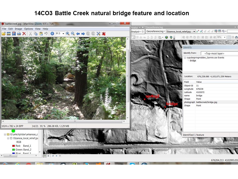
Next we look at the Battle Field and Battle Creek that the natives used for shelter and a location to fight the Spanish. This will be described in the video tonight.
20 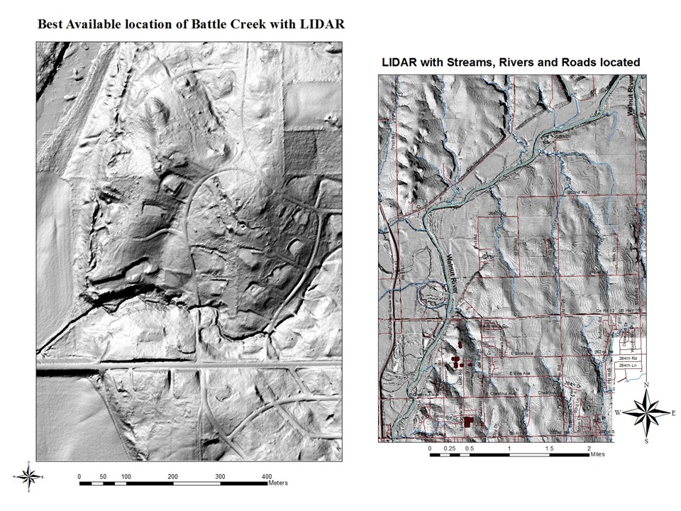
21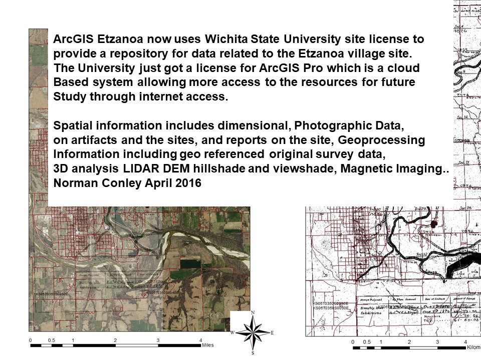
In conclusion the ArcGIS Etzanoa provides a repository for data related to the site reports including metric data showing artifacts, digital elevation and various remote imaging methods.
22 This is the Archaeology channel video on Etzanoa
https://youtu.be/WCPIEoxpFfo
23 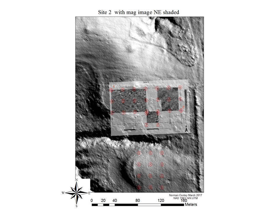
https://www.youtube.com/watch?v=0PNuVwlSeW0&feature=youtu.be