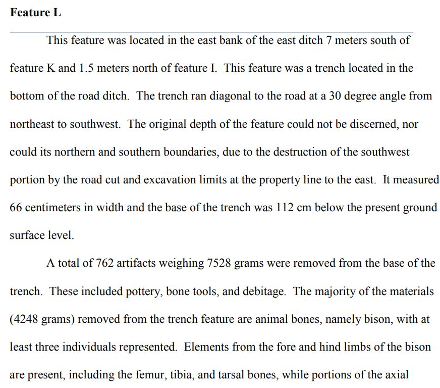
Wichita Ditch Circles
A case can be made for circular ditch
features in the 17th century ‘Wichita’ sites being fortifications
and the site of Etzanoa features. The
entrenchments were observed by the Spanish in the early 18th century
when they moved to the Red River area.
It would not be surprising if the Taovayas
band of the Wichita built circular defensive features after conflict with the
Spanish and Escanyante in the early 17th
century. The features we see at Etzanoa looking like what are called council circles. They are more likely the defensive features
such as those at the Deer Creek site of the same band of native Americans. As a side note evidence of ditches have been found in
Bluff Creek sites and south central Kansas on Bluff Creek.
Archaeological Perspectives on Warfare on
the Great Plains
Edited by Andrew J. Clark and Douglas B. Bamforth University
Press of Colorado Louisville 2018
7. Why Fortify? Force-to-Force Ratios and
Fortification on the Southern Plains Susan C. Vehik
190
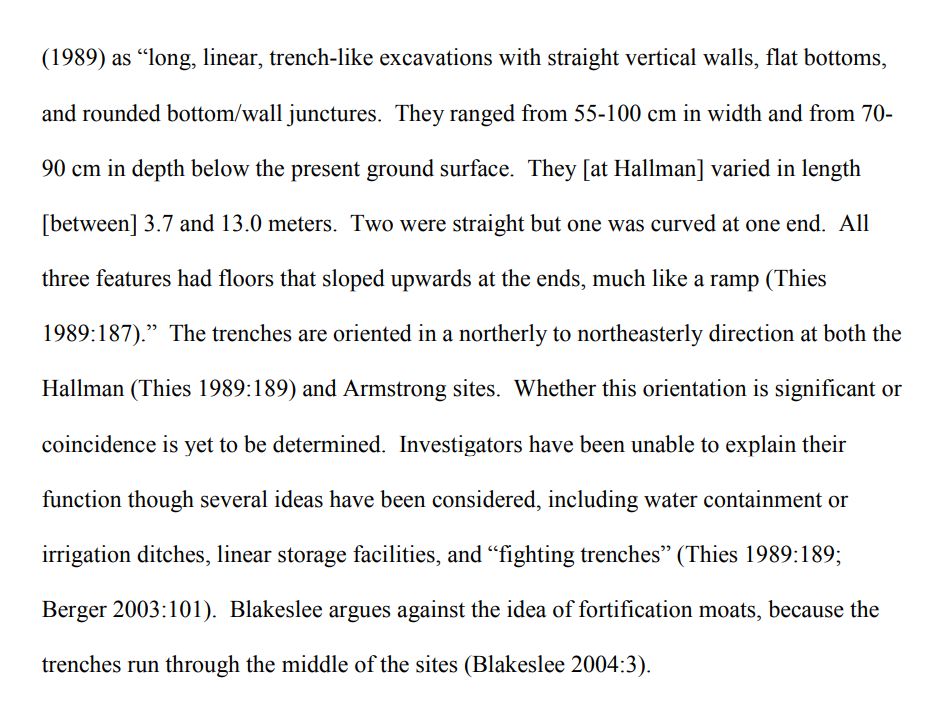
8. Digging Ditches: Archaeological Investigations of Historically Reported
Fortifications at Bryson-Paddock (34KA5) and Other Southern Plains Village
Sites Richard R. Drass, Stephen M. Perkins, and Susan
C. Vehik 211
“Louis Berlandier, in 1830:
“Fortifications are rare among the Texas Indians. They are found in only three
tribes of the same nation, in the villages of the Huecos
[Wacos], Tahuacanos
[Tawakonis], and Tahuaiasses [Taovayas]” (Berlandier
1969:55n47). Some of the earliest, and certainly the most detailed, descriptions
of a fortification come from the Red River village inhabited by the Taovaya from roughly 1757 to 1811. Known today as the
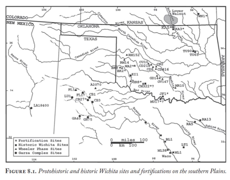
Longest site (34JF1), it is located in Jefferson County, Oklahoma (figure 8.1)
(Bell and Bastian 1967; Duffield 1965; John 1975; Newcomb and Fields 1967). On October
7, 1759, a large Spanish expedition attacked this village in retaliation for
the sacking of the San Sabá mission in central Texas
the previous year by Taovaya and Comanche raiders ( John 1992; Weddle 2007). Arriving at the Red River, the
expedition’s Spanish officers briefly glimpsed the Taovaya’s
defenses before being driven off by mounted Comanche and Wichita warriors.
Captain Juan Ángel de Oyarzún
later wrote how he saw “at the short distance of a gunshot, a village
consisting of oval-shaped huts enclosed by a stockade and moat, and that its
entrance road is enclosed in the same manner” (Weddle 2007:124). Within the
enclosure, Taovaya warriors with French muskets fired
across the river at the Spanish.”
“Fortification Features at Bryson-Paddock (34KA5) and
Related Sites Archaeologists, ethnohistorians, and artifact collectors long
suspected the presence of fortifications at the eighteenth-century sites,
Bryson-Paddock (34KA5) and Deer Creek (34KA3), located on the west side of the
Arkansas River approximately 2 km apart from one another in far northern Kay
County, Oklahoma (figure 8.1). Based on maps and French accounts, members of
the Taovaya subdivision apparently occupied
Deer Creek, in contrast to BrysonPaddock’s Wichita
subdivision inhabitants (Vehik 1992:327).
Bryson-Paddock is north of Deer Creek on a high bluff overlooking the west side
of the river. In one historical account, French traders passed through the
villages on their way from Louisiana to Santa Fe. Arrested and interrogated by
suspicious Spanish officials in Santa Fe, the traders described the villages,
mentioning fortifications, but provided no details (Wedel 1981). A third
eighteenth-century site, Neodesha Fort (14WN1), is located on the Verdigris
River in southeastern Kansas. Like Bryson-Paddock and Deer Creek, Neodesha Fort
was one of a pair of Wichita villages occupied simultaneously. One of the
Neodesha sites may have been visited by Claude Charles Dutisné
in 1719. But, he made no mention of a fortification at
the time of this visit. Today, the Neodesha Fort site has been mostly destroyed
by modern activities and the location of the second village is not known.
Visitors to the Neodesha site beginning in the 1870s through the 1930s, however,
recorded evidence of ditches and Digging Ditches 217 ramparts. The earliest
descriptions indicate embankments 0.6 m high by 3.7 m wide laid out in a U-shape
over an area estimated at 117 m by 146 m (Weston and Lees 1994). One or two
ditches were present just outside of the embankments and these are estimated at
1.2 m deep and about 3 m wide at the top. Like Neodesha Fort, no excavations
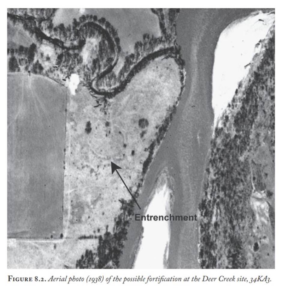
have occurred at Deer Creek. Surface collections, however, suggest an early
eighteenth-century occupation (Sudbury 1976). A large portion of Deer Creek has
never been plowed and a possible fortification ring is very visible (figure
8.2). Early maps of the fortification indicate a U-shaped ditch about 76.2 m in
diameter with adjacent earthen embankments around the head of a draw (Corbyn
1976). The draw may be an entryway allowing protected access to a spring on the
edge of the nearby”
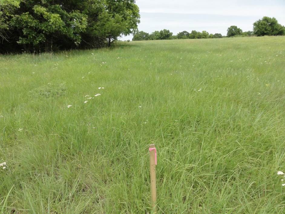
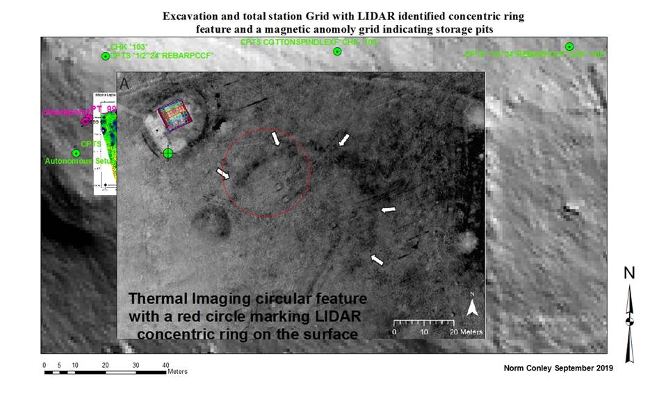
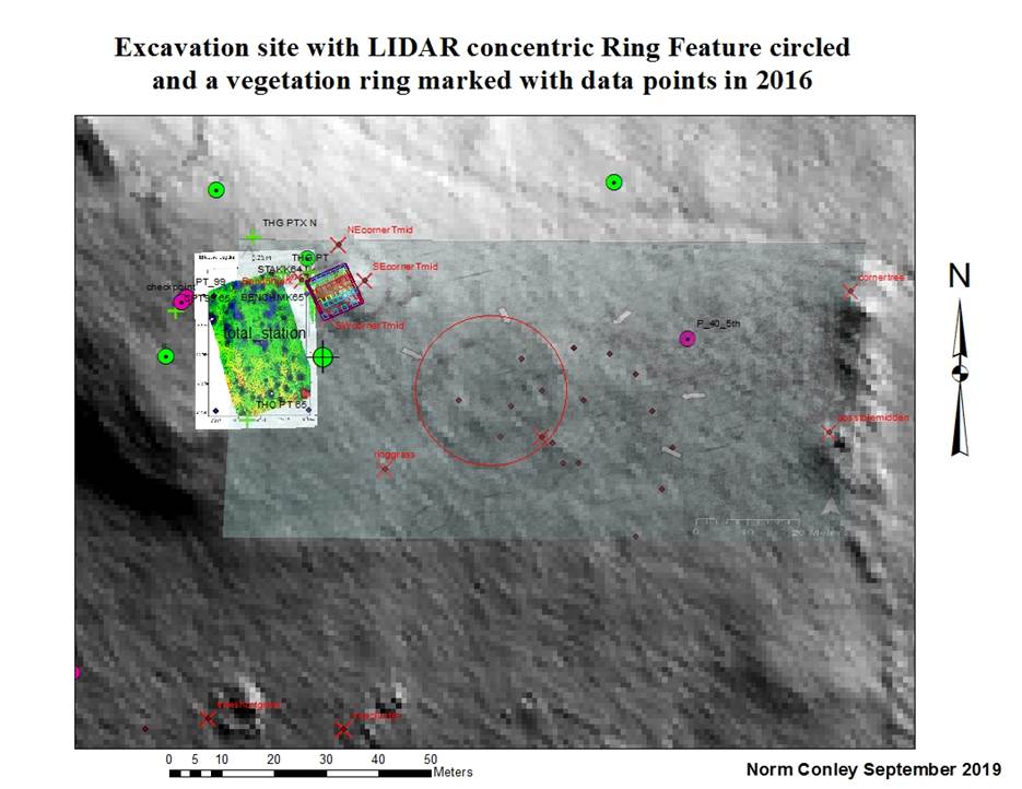
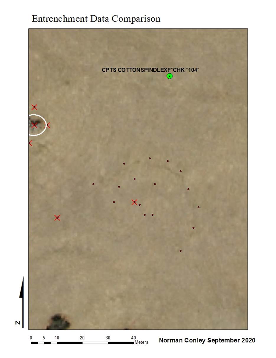
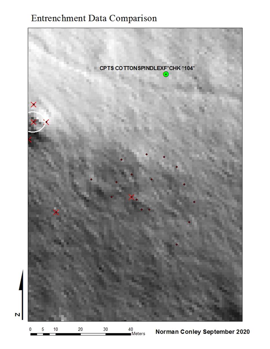
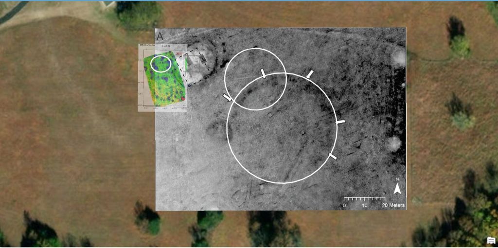
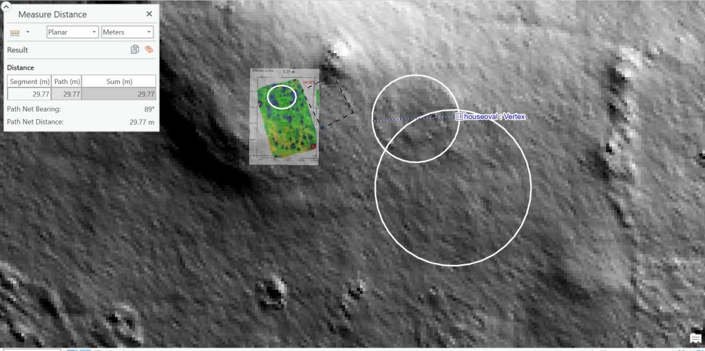
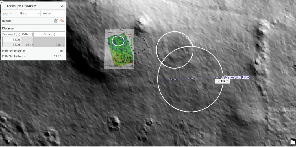
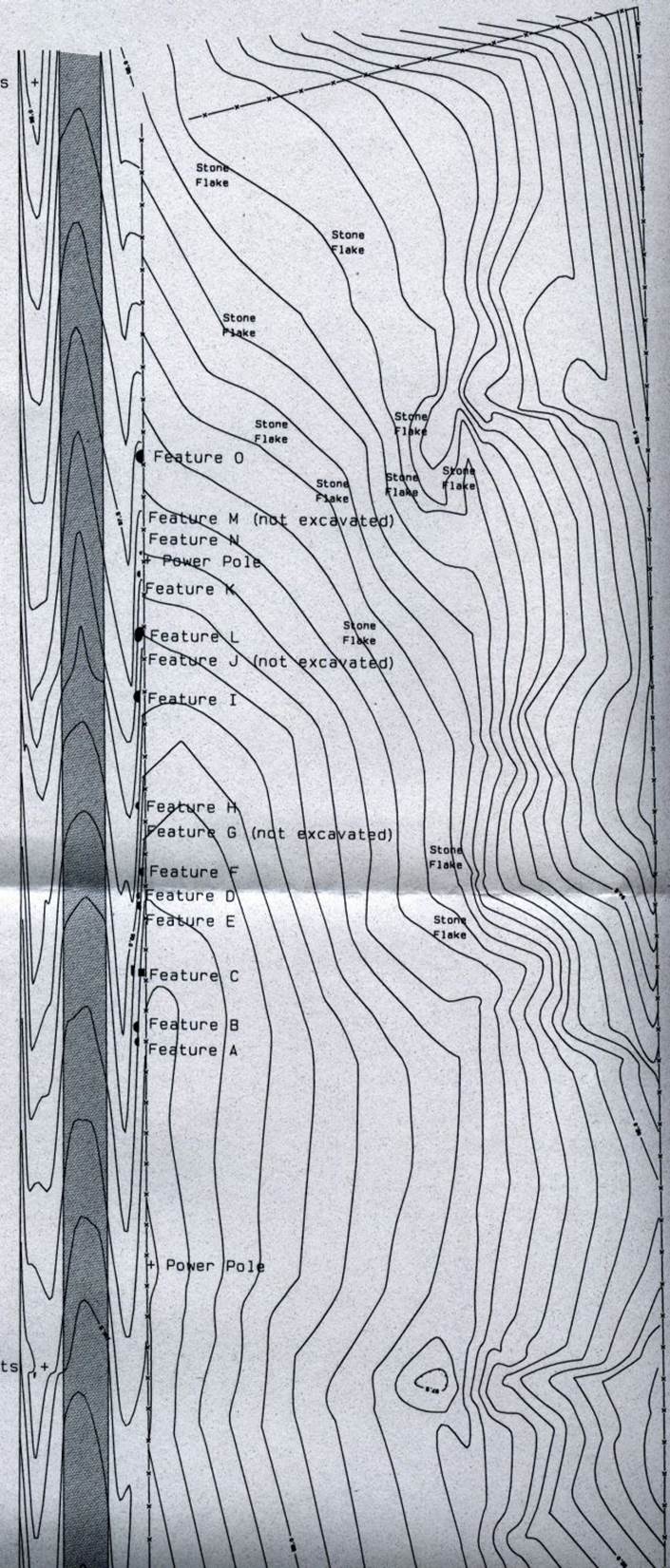
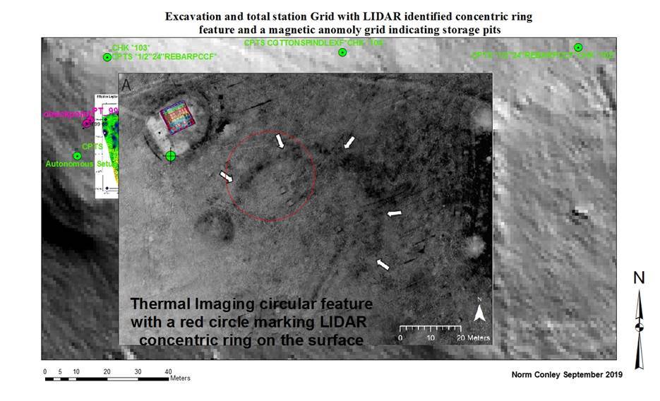
Some remote sensing maps of Etzanoa
on the House Property are currently being studied show evidence of these rings. Both the LIDAR and vegetation heat maps show circular
features in the saddle back of the ridge on the property.
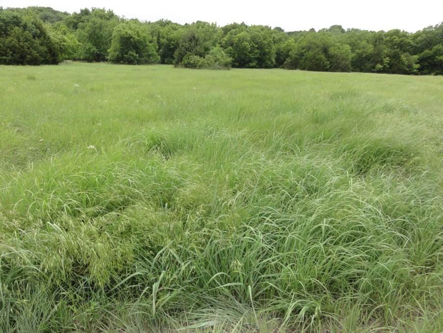
Looking south across one of the vegetation circles
.
From the south survey point looking north toward the saddleback
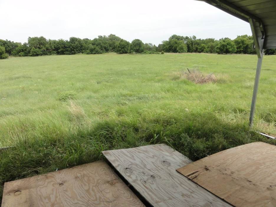
Looking from the excavation cover toward the concentric circle and the vegetation
ring.
The saddleback is seen in this picture also looking toward the North.
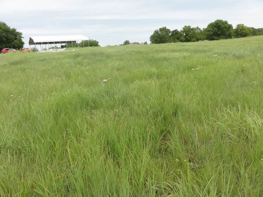
Looking toward the north and the saddleback.
The excavation is under the metal cover.
 .
.
.
Timothy G. Baugh University of Oklahoma, Norman, UK Jay C. Blaine Independent
Scholar
Sixteenth to eighteenth century Wichita
fortifications
Because Wichita defensive structures through time are
closely related structurally, the fortifications are compared as part of this
study. The current section employs both ethnohistorical and archaeological data
to examine Wichita fortifications ranging from the sixteenth to eighteenth
centuries in the central and southern Plains. First and foremost
Kirikir’i·s towns were fortified because.
“Fortifications protect what is most valuable to defenders: their persons,
homes, stored food and property, their livestock and other wealth, trade and
administrative centers, and very commonly their ritual loci” (Keeley et al.
2007: 81). In contrast to the northern Plains and the Southeast, which had
fortifications surrounding entire villages (Dye 2009), the Wichita constructed
small redoubts in one part of the town. Inside Wichita the redoubts were
underground compartments placed to shelter civilians while the adult men fought
both inside and outside of the fortification. Three archaeological sites
(Duncan, Edwards I, and Bridwell in western Oklahoma and the Texas panhandle)
have verified fortified villages that are affiliated with the Wheeler phase (AD
1450–1725) on the southern Plains (Figure 2 and Figures 7–10).
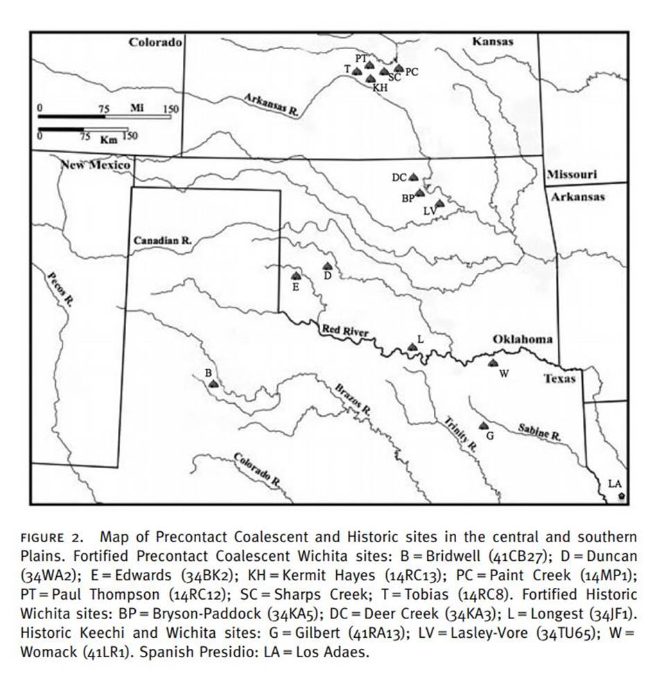
In addition to the redoubts, five sites in central
Kansas may represent fortified villages (Baugh 2007). These include Tobias,
Paul Thompson, Kermit Hayes No. 2, Sharps Creek, and Paint Creek that are
associated with the Little River focus (AD 1400–1675) of the Great Bend aspect
in the central Plains (Figures 2 and 10; Baugh 2009b; Blakeslee and Hawley
2006). Two additional Oklahoma figure 8. Contour map of the Duncan site showing
the ring feature or ditch (adapted from a field map drawn by Richard Drass and final map produced by Mary Goodman, Oklahoma
Archeological Survey). sites, Longest and Bryson-Paddock, provide comparative
data for fortifications from the recent period (Figure 3; Bell and Bastian
1967; Drass et al. 2010; Hartley and Miller 1977). At
the Duncan site a faint circle representing a filled, 50 m diameter ditch is
discernable (Figures 7 and 8).
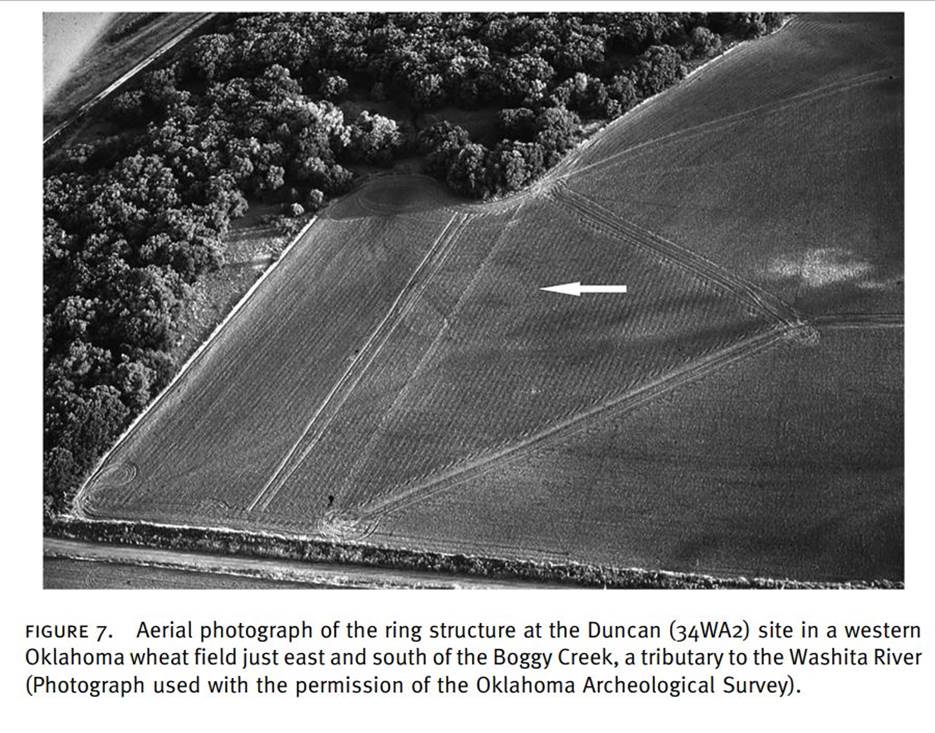
This ditch represents the outermost component of the
Duncan fortification. A trench across the ring and a profile shows a U-shaped
ditch. The surface width of the ditch is 2 m, tapering to about 1 m at the
bottom. The ditch depth is 1 m below ground (Table 2). Sediment from the ditch
was probably thrown to the inside forming a small parapet, perhaps 1 m high and
2–3 m wide. Upright logs were placed into this parapet forming a palisade.
Although archaeological confirmation has yet to be made, the entryway was
probably protected by extending the palisade to form two parallel rows,
allowing only one person to enter at a time. Upon reaching the interior, enemy
fighters were forced to turn to release an arrow while constantly receiving
fire from the defenders. The placement of this fortification by the Okonitsa near a stream had several advantages for the
Wichita. First, it provided easy access to trees needed to form figure 9.
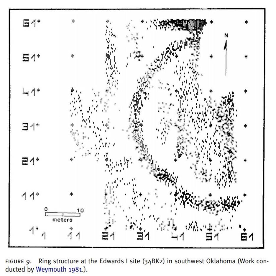
Ring structure at the Edwards I site (34BK2) in
southwest Oklahoma (Work conducted by Weymouth 1981.). the palisade and second,
once the fortification was completed, water could
easily be acquired prior to an encounter and used to withstand an extended
battle. No surface indication of underground or subterranean compartments
existed, but the excavations did not extend beyond the parapet. In contrast to
the other sites, Bridwell (41CB27) has retained its parapet because the site
was never plowed (Figure 2; Table 2).
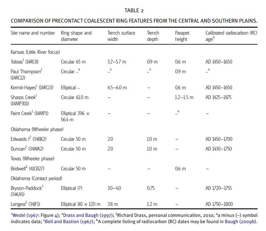
Inside the potential circular ditch is a low (0.6 m in
height) ring-shaped mound, about 50 m in diameter that may well represent the
remnants of a parapet. Associated Southwestern trade pottery from the Galisteo
Basin in New Mexico and obsidian dates place Bridwell within the sixteenth
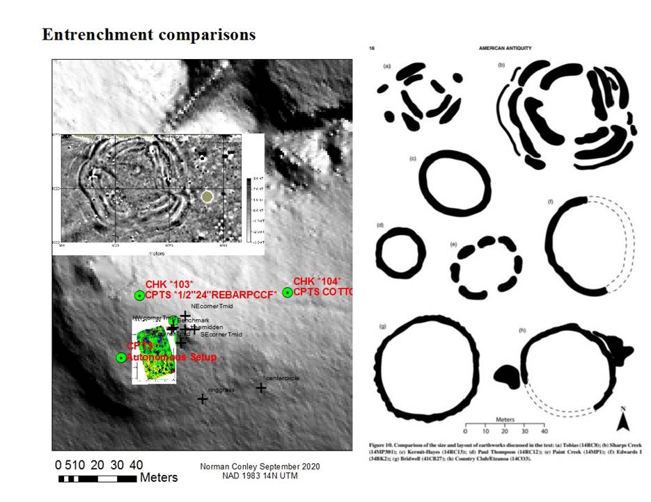
century (Baugh 1986: 171, 179, 1992; Leonard 2006: 242). In 1981, geophysicists
conducted a remote sensing survey of the ring feature at Edwards I and provided
a new perspective on the construction of Coalescent fortifications (Figure 9).
The ring feature or parapet detected from the magnetometer is created by
placing sediments to the inside of the ditch. As top soils tend to have greater
magnetic properties, the feature in Figure 9 becomes visible. The circular
ditch at Edwards I has a diameter identical to the Duncan site (Table 2) and
the parapet was detected (Weymouth, personal communication 1981). The
confirmation of below ground compartments within these fortification in western
Oklahoma have yet to be verified, but like the circular trenches could not be
mapped using the magnetometer. The profile of the excavation units, however, demonstrate
the presence of an external trench surrounding the fortification. figure 10.
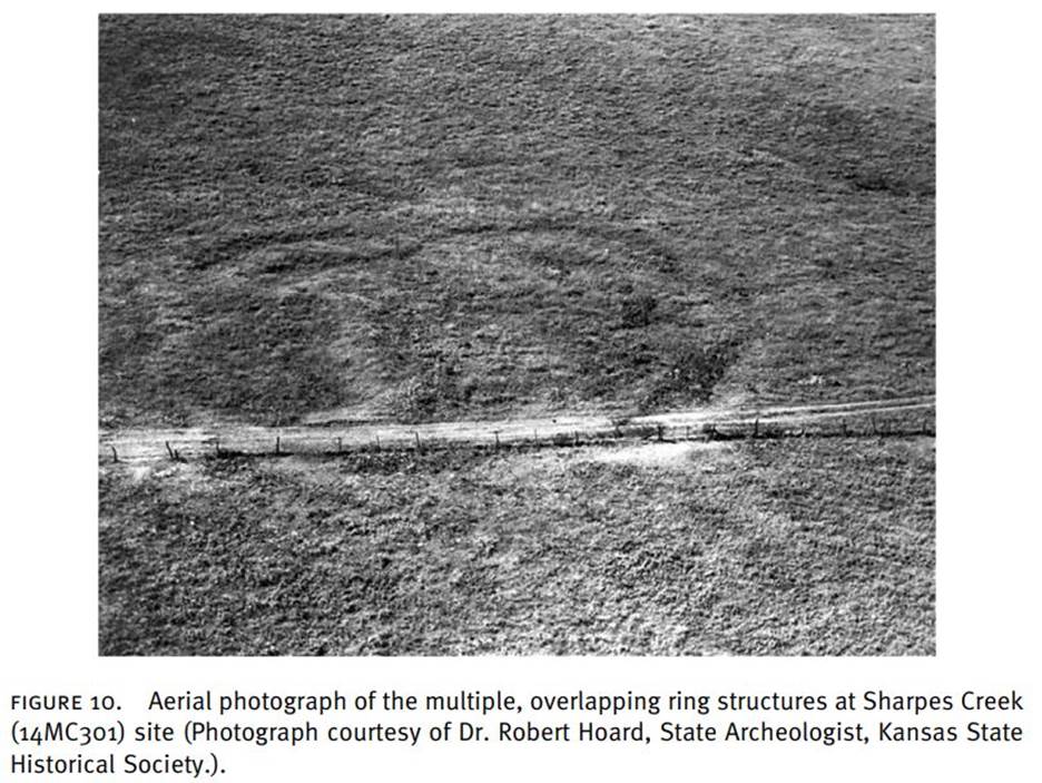
Aerial photograph of the multiple, overlapping ring
structures at Sharpes Creek (14MC301) site
(Photograph courtesy of Dr. Robert Hoard, State Archeologist, Kansas State
Historical Society.).
Description of the ditch feature from the Armstrong
Site Bluff Creek phase from Marcia Bender’s Graduate Thesis:
THE
ARMSTRONG_SITE_DEFINING_THE_BLUFF_CREEK_PHASE_FOR_SOUTH_CENTRAL_KANSAS
Further investigation of the ‘ditching’ of this site
is precluded due to the land being private and the land owner not allowing it.
Conclusion: Increasing
evidence is that some of the circular ditch features (“council circles”) were
in fact entrenchments that we know from the records in some cases been dug
for protection. It is simple physics
that a circular entrenchment involves the least work digging trenches and
enclosing the largest area. Producing
such a circle would only have involved determining a center and marking it.
That may be the reason for finding artifacts
at the center of the features. Then
a pole and cord could be used to layout the area to be ditched. They may have done this also to layout the planform
of their small groups of lodges seen in contemporary drawings. Whether the enclosures were to protect houses
is of some doubt but it seems there is little evidence of post holes that
are not related to the area near the ditches.
It is interesting that the pictures of contemporary camps show the
structures inside a circle with gardens extending out in a ray pattern. The outline of these small groups may have also
been laid out in a similar manner.
Norman Conley
October 2020